Showing posts with label Touring. Show all posts

Wednesday, 12 June 2013

Jutland Tour, Part II: Skagen and Aalborg

And relax..... Finally a rest day.  I think we were both a bit tired of bicycles by this point so a train ride to Skagen was in order. Fortunately the guy at the campsite in Hjorring was very helpful and looked up the train times on the internet for us, so we knew we had an early start.  But we dozed and read eBooks on the way so it was OK (we probably should have been admiring the view or something...).

Two seas


Skagen is on the northernmost tip of Jutland where the North Sea and the Baltic Sea meet, and is the Denmark's most popular seaside resort.  What we didn't know much about was the Skagen Painters movement which was influenced by the French Impressionist with a bit of realism thrown in - fortunately the excellent Skagens Museum told us all about them and they even had a cafe in the studio of P.S. and Marie Krøyer.

The Krøyer's studio in the garden of the Skagens Museum


Garden of the studio looking out to Brondums Hotel
I really liked Skagen (that might have been influenced by the weather!) - it was quite small and very tasteful in the village, with most buildings in the traditional yellow walls and red tiled roofs.  None of the modern brash touristy stuff that you get elsewhere.  In fact, everything in Denmark was like that, even the significant Viking monuments were not over-the-top touristy.

Yellow and red

Skagen Lighthouses


Big sky and sand dunes

The day after Skagen, we cycled south.  All the time we'd been cycling north the wind was in our faces, and we were hoping the change of direction would mean we'd be pushed along by the wind.  But it changed! How unfair!! Fortunately the distance from Hjorring to Aalborg wasn't huge and really there was no route choice.  It was just straight down the road.

Our shorter day meant that we made it to the viking burial site of Lindholm Høje on the north side of Aalborg by lunchtime.  The museum there was excellent, with tonnes of interesting info on the history and use of the surrounding area (and most of it with english translation).  The cafe was run by Brian Blessed's Viking cousin - complete with jolly belly laugh, and a most impressive viking beard.  We had  gorgeous pulled pork sandwiches... which was a relief after days of pizza, burgers and steak.  I don't know where the Danes eat out, but we couldn't find it.  Unless you want mexican italian.  There seems to be a Danish infatuation with mexican pizza (meat and chilli as far as we could work out).  Most strange!

The approach to the Museum takes you past the burial site itself and you get a glimpse of the field - it was quite distracting.... Then when you enter the site you get presented with the view of the whole site.  It is absolutely incredible, the size of site just blew me away.  In much the same way I was in awe of the Callanish Stone circle in the Outer Hebrides, I was completely surprised about how impressive it was.


So far they think there are over 700 graves here dating from around the 5th Century through the Vikings in around 1000AD, and they've recently found evidence of villages on the site.


Triangle grave
The design of the stone settings around the graves gave some indication of their ages.  Earlier ones were laid out in triangles or created mounds, and later ones were ships with larger stones at the prow and stern.


Ship grave

Even Morag Coo was impressed

The following day we had another rest, and spent our time wandering around Aalborg.  First stop the city museum, which wasn't great (but free entry so that's ok!).  There was an interesting exhibition about the tobacco factory but that was it.  We did however find a leaflet for a walking tour of the city....

C18th houses


Aalborg Slot (castle) - now home to civil servants


Jens Bang's House - renaissance architecture at its best!

My favourite bit was the Franciscan Monastery Museum.  The Monastery remains were found when building on the main streets of Aalborg, and still remain under the shopping district.  The entrance was this elevator, unassumingly placed on the side of the street. This was it, put your money in the slot and the doors open and you descend into the depths...  It was all quite surreal.  Amusingly entry to the museum was by weight - if there were too many people in the lift, it wouldn't move!


Stats
Hjorring - Aalborg, 42.9mi


Monday, 10 June 2013

Jutland Tour, Part I: The race north

OK it wasn't really a race but one of the aims for this tour was to make it to Skagen on the northern tip of Jutland, so we decided to try and get there as quickly as possible, then spend the rest our time in Denmark working our way back south, ticking off all the sights that we wanted to visit. I'd already done a rough route plan using the excellent map on the Danish Cycling Federation website which gave us suggested overnight stops and daily mileages (or kilometre-ages as its mainland Europe!).

We met a german guy at the ferry terminal in Harwich who was towing a trailer around the North Sea Cycle Route (now that is crazy). He said it was great for storage and security but way too heavy.  He'd been defeated by the British weather and was going on to Denmark where it was flatter and hopefully less wet/windy.

German style touring

The overnight crossing from Harwich to Esbjerg was hideous. Gale force winds do not make for a pleasant crossing and my tummy was not too impressed. Once off the boat around lunchtime, we headed into Esbjerg and the Tourist Info to buy the missing two maps for the tour.  We had a brief panic as the Tourist Info building was covered in scaffolding and builders, but the lady at the post office pointed us in the direction of the temporary Tourist Info office.

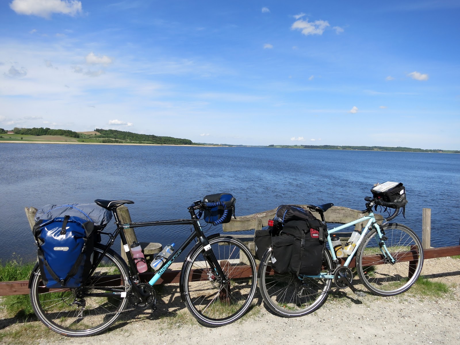
Strapped down and ready for the off
Getting out of Esbjerg wasn't too difficult and we stopped off to have a look at the strange 'People of the Sea' statues... I don't remember much about the route apart from the wind. The storm winds from overnight had continued and trying to keep a loaded touring bike moving was ridiculously hard. I remember when we were on the country lanes, surrounded by fields and no hedgerows - you came out from the shelter of the farmstead and were practically brought to a standstill by the force of the wind.  I think we were both having second thoughts about the whole adventure at this point - if the wind continued to be that bad we wouldn't be getting anywhere....


People of the Sea


The plan had been to get to Skive, but the reality was that we gave up when we got to the end of National Route 2 at Olgod. So we ended up doing only 36 miles the first afternoon.

Day two aim was to get to Viborg (or beyond if possible). To make up time/distance we decided to take the road as far as Herning, as it was more direct than the cycle routes. I wasn't sure about this but it turned out that the roads are quieter in Denmark and most of the time the vehicles give you more room than in the UK.

Herning

Random building in Herning

The wind had slacked off a bit and we made good time in getting to Herning for lunch. After that it was on to the Local Route 21 - the old railway route.  This was the first experience of the proper Danish cycle paths - lovely smooth tarmac, no potholes, and not a road in sight.  As it was the route of the old railway, the path was raised up on an embankment and you got a great view of the surrounding countryside (mostly grass and arable fields).  Going through some villages you could even see the remains of some platforms and station buildings.
What cycle paths should look like.

We got a first experience of Danish village/town churches today as well (the first of many photos).  Iconic whitewashed buildings with red roofs, sometimes with some exposed red brick and a bell tower.  What struck me most was the graveyards, they were so pretty.  Each was beautifully manicured - divided into (family) plots with small hedges and then filled with small shrubs and flowers.  All lovingly maintained.

Karup Kirke


Viborg was lovely.  Situated on the side of two lakes, with the cathedral on a rise above the city.  We arrived and collapsed in the park next to the south lake before working out where the campsite was, and the first thing that struck me was runners.  They were everywhere, single runners and packs of them.  I think that every time we wandered away from the campsite, we saw somebody out running!

Viborg at Sunset


The aim for day three was to get from Viborg to the other side of the Limfjord so we could visit the Viking fortress near Aggersund. Looking at the size of the villages on that side of the fjord, we revised the plan as we didn't think we'd end up being able to find somewhere for dinner.  So the new aim was Logstor, on the south side of the Limfjord.

Big sky

The 'interesting' sand/gravel track down by the Fjord
We used a combination of signed Cycle routes and normal roads.  On one section early on the cycle route went away from the main road and on a minor road down towards the edge of the fjord, so we decided to check out the scenery down there.  The minor road degenerated into a gravel track, which degenerated into a sandy track.  At this point Mal's bike attempted to go sideways and traction disappeared, so we had to get off and push.  The sandy section was only short and before long we were back cycling on gravel.  That was still a bit skittish though and there was a lot of concentration involved in trying to keep the bike upright and moving forward, and trying to pick the line on the track that had the least gravel.

Spot the intrepid Traveller?
Given that we did 60 miles, I'm not sure how we managed to get to Logstor in time for tea and cake.  But we did.  And we had 'speciality of Denmark' cake, which was described to me as having special egg foam.  Turns out that's a very posh Tunnocks tea cake.  They were very nice though.  The tea however.... It's best to stick to coffee outside of the UK I think....

Post tea/cake we mosied on down to the campsite and set up the tent, then decided we had enough time to cycle across the bridge over the Limfjord to check out Aggersund (better than trying to fit it in before the next day's epic cycle).  Photos don't do it justice...


Aggersund Viking Fortress
OK, so it is a big grass covered circle.  But it's big.  And you can see why that clever Harold Bluetooth built it here - the narrowest point of the Limfjord and some cracking (strategic) views!

The kirke at Aggersund


By day four of the big push north, I think we were both feeling a bit dazed.  The original plan had been to go to Frederikshavn on the coast, and then get the train to Skagen the following day as our rest day. But that was quite a long way, and after some studying of the Lonely Planet guide Mal discovered that Hjorring was closer, nicer (Frederikshavn = industrial port, Hjorring = pleasant historical town), and we could still get the train to Skagen from there. We used mostly main roads for the route so it was more direct, and I remember it being hilly (for Denmark) and windy, but not much else.  

Stats:

Esbjerg - Olgod, 37.9mi
Olgod - Viborg, 65.1mi
Viborg - Logstor, 60.7mi
Logstor - Hjorring, 55.2mi


Sunday, 23 September 2012

Sun 23rd: Elgol and Sleat

Yet again I made a slight mistake with the distance planning and the route for the day was going to be less that 20 miles from Broadford to the ferry terminal.  So we came up with a new plan involving cycling out to Elgol to get the view up Loch Coruisk into the Cullin horseshoe.

Our hosts for the night kindly let us leave the panniers behind to be picked up later and we set off down the road with much lighter bikes. The difference was remarkable - the handling changed and the effort involved in getting going was much more noticeable than expected.

For a dead end road it was quite busy - I guess as Elgol is a popular visitor destination, but the sun was shining, there was little wind and we had no luggage!  First stop before we reached Torrin was a bit of a traffic jam, a herd of cows being led down the road by the land-rover to their new grazing.  A few impatient car drivers trying to push past, but we just stopped and waited.  Mooing cows are quite loud when standing right next to you calling their calves!


Friday, 21 September 2012

Fri 21: Trotternish

I was kind of dreading today - the first ride on Skye and the threat of proper hills and all starting with an early call, little breakfast and a ferry ride.

We made a bit of a faux-pas to begin with - after the relaxed attitudes of the Western Isles we turned up at the ferry terminal 20mins before sailing without having bought our tickets, so a disgruntled CalMac ferryman sent us off to the ticket office to purchase tickets.  We got the tickets and boarded without a fuss but it was a bit of a change to the previous few ferry rides where it was just turn up, get on, buy ticket.

Coming in to Uig we could see the hills surrounding the village, but in the end the climb didn't seem that bad just a steady plod with a couple of switchbacks.  Once over the brow there was a fantastic view of the coastline of the northern end of the peninsula backed by the hazy sight of the Harris hills across the water. I hadn't been this far up the Trotternish before and it was stunning. It helped that the weather was pretty good as well!

Of course with the weather it meant that we had to keep stopping to take pictures (Morag insisted) - the hills were still a bit hazy but it was definitely the best weather we'd had all holiday.  The coastline is ace - lots of cliffs and bays, and granite columns - of course that meant we were constantly descending into bays and climbing out over the cliffs.  But it really didn't feel that bad.  I think I'd been conditioned by the days in the Western Isles and then the rest day yesterday.  The remembered climb up to the Storr was all I recalled...


After the Storr (why is there no visitor centre/cafe at The Storr?? Least it looks like they're building a car park....) there was another short climb before the view of Portree was laid out before us, along with an ominous looking cloud hanging over it! Cracking descent and then into Portree where there was traffic - that was a bit of a shock!! Not used to having to concentrate on the cars around us, trying to squeeze past at traffic islands, general impatient-ness.....


Thursday, 20 September 2012

Thurs 20th: Lewis to Harris

Ok we cheated. We were both tired after five days of cycling and not looking forward to the cycle back from Stornaway to Tarbert after having already done most of it in the other direction. So as we were on holiday and could do what we liked- we got the bus!!

Bikes and panniers easily went in the luggage compartment and it trundled back over the Harris hills to Tarbert.

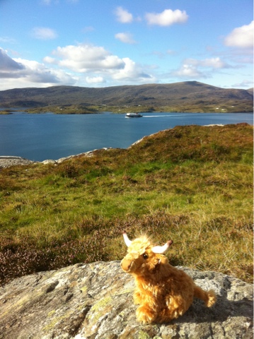
Morag the Travelling Coo
Once back, we had the great idea of cycling out to Scalpay island - round trip of approx 16 miles, but not before acquiring a small Highland heifer who wanted to come along for the ride...

On the road to Scalpay looking towards S.Harris and the CalMac ferry
I'm so glad we did - it was lovely. Not a flat ride but the road dipped down into coves and over headlands. The community cafe/shop on the island was fantastic - very friendly, humongous pieces of cake and endless tea. After a while stuffing ourselves we pooled to the end of the road and thought about walking out to the headland to look at the lighthouse. But then it started raining. So we didn't!

On the way back Harris threw it's best as us yet again - absolute downpour/hailstones the lot. Luckily we'd learnt from previous episodes and put waterproofs on 'just in case'!
From Scalpay looking back towards the Harris Hills


Tuesday, 18 September 2012

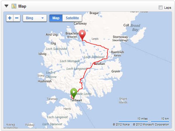
Tues 18th: Harris to Lewis

Today was going to be the hardest day with the biggest planned climbs of the holiday (not counting potential diversions!) over the Harris Hills - so there was some attempt to be up and out promptly, although we were both complaining of aching muscles.

That's the sea in the far distance!
From Tarbert we were into the climb pretty much straight away- up from the coast along a 1 in 10 hill and the first use of granny gear! After the initial steep climb it levelled out a bit, so I had a brief break to catch my breath before starting the rest of the more gradual climb.

As you go up the landscape really changes, from the coastal inlets and sweeping bays to the more rugged hills that feel a lot more like the Scottish highlands that we're so familiar with. After spinning up for a while (maybe an hour?) we made it to the top of the pass and were rewarded with a cracking view of the upland freshwater loch, the surrounding hills and down to the sea.

At the top!
Whilst hanging around taking pictures we saw another bike tourer approaching from the other side of the pass- he was on a three week tour and had significantly more stuff than us. Before getting too cold we continued on with a gradual downhill. I absolutely loved this stage- I'd just done my first ever 'big' climb on a laden bike and didn't kill me, the sun was shining, there were blue bits in the sky, and there was some amazing Scottish highland scenery.
Loch Seaforth - looking back at the Harris hills

Before too long we were back to climbing to get over the last of the Harris hills, and then were rewarded with the sight of Loch Seaforth below us, and a band of rain coming towards us! We figured it would only be a short shower so didn't break out the waterproof trousers, but on the fast sweeping descent we hit the wall of water, more like hailstones really - and were soaked in 30s.  Its fun when you're breaking on a fast descent with a laden bike and your hands have gone numb!!


We need a stop then, hungry, knackered and soaked so we headed for the Loch Erisort Inn, a few miles off the main road.  We got there a bit early but fortunately the owner saw us arrive and let us in, cranked up the fire and sorted us out with lots of tea! Not to mention a demanding elderly collie with an eye for the tennis ball...

We tried to warm up but after the soaking it was a bit of a struggle so we decided to crack on.  After the climb over the Harris hills we thought it would be plain sailing for the rest of the day, but there were quite a few short sharp climbs.  Eventually we reached Achadh Mor for the final descent down to Callanish - but the wind picked up and it was a real struggle.  It was so frustrating - you could see the coast in the distance, the moorland was fairly flat with just gentle rises, but the wind was relentless.

Finally we reached our destination, and dived into the Visitor Centre for the Callanish Stone Circles to top up on tea and cakes.  The Stone Circle itself is amazing - there are so many stones still there and they're huge!  This is the largest of three circles all within sight of each other.


Monday, 17 September 2012

Mon 17th: North Uist to Harris

Carrying on round the coast of North Uist with it's White sandy beaches, we were soon on the causeway and then on to Berneray. The village gets a good write up, so we checked it out before heading for the ferry terminal.

It's georgous!! Harbour bay surrounded by cottages. We sat on a bench and watched the seals sunning themselves on the rocks. Eventually we got a but chilly so headed off to the cafe for tea before the lunchtime ferry.


Disaster! Ferry cancelled due to exceptional low tides! No other option but to wait for the next one at four o'clock... This was not good - our plan once on Harris was to do the 20 mile rid from Leverburgh to Tarbet which included our first ever experience of hills on a laden touring bike. I was worried....

So there was a tense wait, more tea and cake consumed, and lots of watching the tide come in.

Finally the ferry arrived. I then completely understood why the previous one was cancelled. The sound of Harris is really shallow with lots of small islands and sandbanks, and the route between the two harbours is circuitous to say the least. The ferry was making some very sharp turns around the marker buoys and I'm sure that at some points the depth alarm was going off!!


Once on Harris it was time to crack on - 20miles, some hills, and two hours of daylight left. The climb up from Leverburgh was a steady plod and then we got to the top and rounded to corner to see some absolutely stunning coastline laid out before us. Beautiful sandy beaches!


Then further on Harris golf course with it sternly worded "No playing on Sundays" sign. Bless. And some great beaches with crashing waves and plumes of spray. We had to keep stopping to take photos! Amusingly we saw the same people at each stop, so it looks like a bicycle is a quick as a car on Harris...

Eventually though we had to crack on and head up and inland away from the amazing beaches. The first climb was a short stiff 1in10 (?) but then it slacked off a bit. The landscape here was completely different to anything we'd seen on the islands so far - brown, with big boulders everywhere, it really felt in the middle of nowhere. We plodded on upwards, eventually reaching the top of the pass. I was so relieved. I'd been quite worried about my ability to haul a laden bike up hills. And actually it really wasn't that bad. OK, in the grand scheme in things they're not very big at all but everyone has to start somewhere.

The there was the cracking fast descent to Tarbert, but the sting in the tails was the heavens opening just as we got to the village. A few minutes cycling in that and we turned up at the B&B looking like drowned rats!